


Longer Days...
The sun is rising a lot earlier at this time of year. Or so they are telling me. The weekends fill up with kids demands and an ever growing "to do" list around the house. Plus with all that rain the grass is growing like crazy! So the best way for me to get a long ride in on the weekend is to get up real early. This Saturday I got up at 5:00 am and headed out around 5:40 AM. I mapped out a 47 mile route and was looking to be home around 9:00 am.
the weather had been calling for fog, overcast, and slight chance of rain. Well it was foggy, but it was also very sticky. It was around 60° and humid. It was right at the dew point.
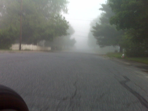
Morning Fog, originally uploaded by Martinator.
The fog wasn't so bad to deal with. It was the "Misting" the constantly hit my sunglasses during the first 15 miles that made visibility poor.
Cleaning My Glasses
It was getting silly. I could clear my glasses with my shirt because it too was getting wet. Not "wet" wet, just wet enough to be useless for cleaning glasses. I stopped off at Cole's Tavern and found some garbage in the parking lot. As luck would have it there was a napkin. I used it to clean off my glasses. Great! Now I could see again! That lasted for a couple of more miles until the "Misting" got them all covered with "wet" again.
Rhode Island
The "Misting" had stopped by the time I hit Rhode Island. I stopped at the Cumberland Farms and reloaded my bottles and cleaned off my glasses. It was beginning to threaten sunshine...
Douglas Turnpike
I have never been on this road before. It is a nice, straight, rolling climb back into Massachusetts through a very rural wooded area. I didn't take it all the way to Douglas, MA. Instead I had mapped out a shortcut back through Uxbridge, MA. There was only one problem though...

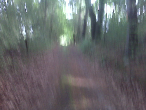
End of the Road, originally uploaded by Martinator.
Hathaway Lane ended abruptly as I can upon the cul-de-sac. When I had mapped this out on MapMyRide.com, the Google map there indicated that Hathaway Lane went all the way through. It was only half right. As you can see, there is a dirt road beginning right at the end of the cul-de-sac. I tried to ride down it, but after 10", I got off. It was too wet, soft, and muddy. I had the "track" I plotted downloaded onto my Garmin eTrex Legend GPS. I has also plotted out the waypoints for each turn. My Garmin was telling me that it was only ~1/10th of a mile to the next turn, which I was gambling on being back onto a paved road. The roads around here were unknown to me and I didn't want to re-route. So off into the woods I went.
Into the Woods I Go...
The "dirt" road I was walking on resembled an old fire road through the woods. It was still drivable if you had a Jeep, or a tractor (The road abutted farmland). Lots of mud, puddles, and mosquitos. Thankfully it was a short walk. The funny thing was that when I got to the other side, this "road" actually had a road sign (yes, it was still called Hathaway Lane).
"Old" Hathaway Lane, originally uploaded by Martinator.
Sorry for the blurry picture. There was a lot of condensation on my BlackBerry. The light at the end of the road turned out to me my next waypoint and it was back onto pavement :-) I probably shortened the lifespan of my cleats a bit, but what is one going to do?
Back on Pavement
It was good to get back on pavement on Chockalog St. I banged as much dirt out of my cleats as I could and got back on the bike. I'll have to remember to re-map this ride when I do it again.
PHAT Encounter in Uxbridge
As I was pedaling up Henry St. in Uxbridge when I saw a rider coming down. I hardly ever see other riders on this road. Soon behind this first rider I saw another coming down. This time I noticed her was wearing a "PHAT Tuesday" jersey. It turns out it was Kevin Robbins. this was confirmed in the thread attached to my FaceBook Status.
Home by 9:07 AM
I got home just as breakfast was hitting the table :-)
47.1 miles by 9:07 in the morning. 14.6 mph average. Not bad I guess given that there was 3,074" of climbing
Pan Mass Challenge
Please visit my PMC Profile, read my story, and sponsor me as I ride for a cure.
- Marty Rides the PMC FaceBook® Page - Become a Fan!
0 comments:
Post a Comment