East South-East for a Change
I've been looking at my routes an I for a while I've noticed I haven't ventured very far East/South-east from my home. So I mapped out a route to my frineds house in Mansfield, MA and headed out. I tried to do this route once before, but my spoke broke a mile into the ride [Hottest Day (So Far), Shortest Ride...]. I ran into more elevation changes than I expected. I don't know why, but I thought I would be just going "down" into Mansfield, and then back "up" home. Little did I realize that there was also a lot of up and down in Foxboro.
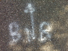
BNB Markers
When I've biked through Millis I've seen an occasional BnB Route marker. However they are often faded. On this ride, I've seen a good number of BnB route Markers painted on the roads. I think that may be part of the Bikes Not Bombs organization, but I see nothing on their site regarding a ride in the South Western Suburbs. Maybe it is some other group...
Rail Trail in Mansfield?!?
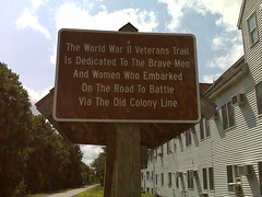
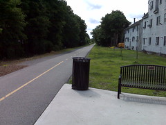
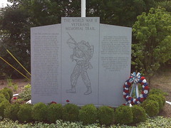
As I approached downtown Mansfield, I was surprised to come across a Rail Trail (Technically, it is a multi-use path...). It is about 2 miles long and occupies what used to be the the Old Colony Line. From the Google Earth view, it looks to be a straight shot out of town. I wonder if there are any plans to expand it or connect it to any other Rail Trail networks.
Roads and Traffic
Usually when riding on different roads, you run into trade-offs. A "Well Traveled" road will more often than not be better paved and have a wide shoulder. "Back roads" may not be so well paved, have no shoulder, but also have little to no traffic.
Biking back from Mansfield I found a well traveled road that had a crappy surface and no shoulder. Oh, and I also had to cross 3 4 lane roads: 140, A corporate park road near 106, and route 1. I hit the light just right on route 1 (I was thankful there was a light as I wasn't sure if there would be one at that location).


0 comments:
Post a Comment